Edgewater Dr. Bridge information (Port Charlotte area)

Bridges along Edgewater Drive in Port Charlotte, FL

    Click on bridge for more information

    Marker BridgeBoat ClearanceGPS
    1Edgewater Dr. over COMO WATERWAY26°58’27” N, 82°09’51” W
    2Edgewater Dr. over PELLAM WATERWAY26°58’25” N, 82°08’10” W
    3Edgewater Dr. over West Springlake Waterway26°58’24” N, 82°07’12” W
    4Edgewater Dr. over East Springlake Waterway26°58’24” N, 82°06’57” W
    5Edgewater Dr. over SUNRISE WATERWAY26°58’16” N, 82°06’23” W
    6Edgewater Dr. over ELKCAM WATERWAY10ft26°57’56” N, 82°05’49” W
    7Edgewater over OLMAN WATERWAY
    26°57’52” N, 82°04’57” W

    The Peace River

    The Peace River is a stunning waterway that runs through central Florida, USA, and has played a significant role in the history and development of the region. The river stretches 120 miles, originating in the Green Swamp near the Polk and Hillsborough County line and flowing into Charlotte Harbor on the Gulf of Mexico.

    The river has been a vital source of water, food, and transportation for the indigenous populations that lived in the area for thousands of years. The Native Americans who lived along the Peace River and its tributaries relied on the river for fishing and hunting, as well as for irrigation and transportation. They also used the river as a source of freshwater, which was essential for their survival in the often-arid Florida climate.

    In the late 1500s and early 1600s, Spanish explorers arrived in the region and established missions along the Peace River. The Spanish were attracted to the area because of its abundant natural resources and strategically-important location, which allowed them to control access to the Gulf of Mexico. The Peace River became an important transportation route for the Spanish as they expanded their control over the region.

    In the early 1800s, American settlers began to arrive in the region, and the Peace River quickly became an important transportation route for them as well. The river was a vital link between the Gulf of Mexico and the interior of Florida, and was used by merchants and settlers to transport goods and supplies. The river was also used by the U.S. military during the Seminole Wars, which lasted from 1817 to 1858, as they tried to capture or remove the Seminole people from Florida.

    Throughout the 19th and early 20th centuries, the Peace River remained a vital transportation route, but its importance diminished as railroads and roads were built in the region. The river was still used by locals for fishing, hunting, and as a source of freshwater, but its significance as a transportation route declined.

    In the mid-20th century, the river began to gain attention again as the region’s population grew and the demand for water increased. In the 1950s, the Peace River was identified as a potential source of water for the rapidly-growing city of Tampa, and the Peace River Basin Board was established to manage the river’s water resources. The board was later replaced by the Southwest Florida Water Management District, which continues to manage the river’s water resources to this day.

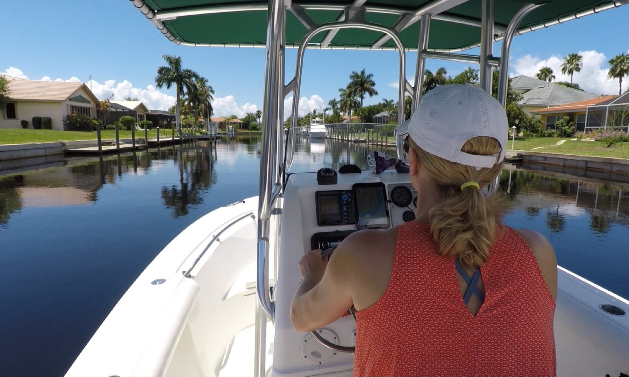
    Today, the Peace River is still an essential source of fresh water for central Florida, but its significance goes beyond just water. The river is now a popular destination for outdoor recreation, such as fishing, boating, and kayaking, and is home wildlife such as alligators, manatees, and a wide range of bird and fish species. The river is also a significant ecological resource, as it provides habitat for a variety of plants that and also helps to recharge the region’s aquifers.

    In conclusion, the Peace River has a rich history and has played a significant role in the development and growth of central Florida. The river has been a source of water, food, and transportation for thousands of years, and continues to be an important resource for Southwest Florida today. Whether you’re looking for a place to fish, kayak, or just enjoy the beauty of nature, the Peace River is a must-visit destination.

    Charlotte County and the General Development Corporation

    The General Development Corporation (GDC) and the Mackle Brothers, J. Lowell and Robert, were significant players in the development of Charlotte County, Florida during the 20th century. This article will examine the history of the GDC and the Mackle Brothers and their impact on the growth and development of Charlotte County.

    The General Development Corporation was founded in the mid-1940s as a land development company. The company was created to buy large parcels of land in Florida and then sell smaller lots to individuals looking to build homes. GDC successfully acquired large tracts of land and quickly became one of the largest land developers in Florida.

    The Mackle Brothers were two of the five founding partners of the GDC. The brothers had a passion for land development and saw a huge opportunity in the Florida real estate market. The Mackle Brothers were instrumental in the success of the GDC, using their business acumen and marketing skills to drive sales and attract new buyers to the Charlotte County area.

    GDC and the Mackle Brothers focused their efforts on developing Port Charlotte, a small town in Charlotte County. Port Charlotte was a natural location for the GDC, as it had abundant land, a mild climate, and was close to several popular tourist destinations in Florida. The GDC and the Mackle Brothers saw the potential for Port Charlotte to become a thriving community and began buying large tracks of land in and around the surrounding area.

    GDC and the Mackle Brothers were successful in their efforts to develop Port Charlotte. Over the next several decades, Port Charlotte grew from a small, rural town into a bustling, thriving community. The GDC and the Mackle Brothers were responsible for much of the growth and development of Port Charlotte, building thousands of homes, shopping centers, and community facilities that helped to make Port Charlotte a desirable place to live.

    Despite the success of the GDC and the Mackle Brothers, there were challenges along the way. One of the biggest challenges was the rising cost of land in Florida. As land became more expensive, the GDC and the Mackle Brothers had to adapt their business model to remain competitive. The brothers responded by developing new marketing strategies and expanding their business into other areas of Florida, including Cape Coral and Sarasota.

    Despite these challenges, GDC and the Mackle Brothers continued to develop Charlotte County successfully. In the 1970s, Port Charlotte became one of the fastest-growing communities in Florida, and the GDC and the Mackle Brothers were instrumental in this growth. The brothers were also active in the community, supporting local schools, charities, and organizations.

    The GDC and the Mackle Brothers profoundly impacted the growth and development of Charlotte County. The company and the brothers helped turn Port Charlotte from a small, rural town into a thriving community attractive to new residents and businesses. GDC and the Mackle Brothers also positively impacted the local economy, creating thousands of jobs and helping spur economic growth in the area.

    In closing, the General Development Corporation and the Mackle Brothers, J. Lowell and Robert, were major players in the development of Charlotte County, Florida during the 20th century. The company and the brothers were passionate about land development and saw a huge opportunity in the Florida real estate market. The GDC and the Mackle Brothers were instrumental in the growth and development of Port Charlotte, building thousands of homes, shopping centers, and community facilities that helped to make Port Charlotte a desirable place to live. Their impact on Charlotte County will be felt for generations to come.

    Severin Waterway (Edgewater)

    Severin Waterway, located in Charlotte County along the north bank of the Peace River, is known to some as old sailboat row. The sailboat friendly waterway runs north and south and is part of the larger Beeny and Bangsberg Waterway system. The entrance of the canal is directly across from Fisherman’s’ village in Punta Gorda, a boat friendly destination with many specialty shops and restaurants. The Peace River combines with the Little Alligator Creek and the Myakka River and flows into Gasparilla Sound, also known as Charlotte Harbor. Charlotte Harbor along with many of its connected canal systems are known as a boater’s paradise for their wide variety of wildlife.

    Lister Waterway | Buena Vista Area Waterway | Port Charlotte Florida

    In this video, we take you on a short tour showcasing Lister Waterway in Port Charlotte FL. Lister Waterway is part of the Buena Vista waterway system and is in what some refer to as the “old sailboat section” of Port Charlotte. It is located just north of the Peace River, and directly across from Fisherman’s Village in Punta Gorda. We include canal depths and other general waterway information reverential to boaters and those interested in waterfront living.