Keep a close eye on your seawall. It is a “living and breathing” structure that stands up the forces of nature.
The following are signs that a seawall may be failing:
Cracks or gaps in the wall structure
Tilting or leaning of the wall
Settling or sinking of the soil around the wall
Erosion of the soil near the base of the wall
Rust or corrosion on metal components
If you suspect that your seawall is failing, it is important to take action promptly to prevent further damage and ensure the safety of your property. You should consider hiring a professional engineer or contractor who specializes in seawall repair and maintenance to assess the condition of your seawall and recommend repairs or upgrades as needed.
Depending on the severity of the issue, the repair process may involve patching cracks or gaps, shoring up the base of the wall, replacing damaged components, or even rebuilding the entire structure. In some cases, additional measures may be necessary to prevent soil erosion or protect the wall from future damage.
Areas surrounding Charlotte Harbor are the perfect place for new home buyers who love fishing and telling fish tales. Located on the Gulf of Mexico, this coastal town offers a diverse range of fish species that can be caught throughout the year and a whole lot of fun along the way.
As the months change, so do the types of fish that can be found in the waters surrounding the bay, and the opportunities for creating family memories and those never exaggerated fish stories.
In January, anglers can expect to catch sheepshead, redfish, and black drum. These species are known for their tough exterior, but they’re softies when it comes to a good joke. Sheepshead, in particular, are a favorite among local fishermen as they are known for their delicate white meat. They can be caught around the docks and piers around the harbor and canals, making them a popular target for those who like to fish from shore and tell a good joke.
February brings in the start of snook season. Snook, also known as the “linesider,” is a popular game fish in Florida and is highly sought after by both recreational and commercial fishermen. They are known for their hard fighting and acrobatic jumps, making them a thrilling catch. They can be found near the inlets, bridges, and mangrove shorelines and can be caught on live bait or lures, and some good luck.
March is the time for tarpon to arrive in Charlotte Harbor. Tarpon are considered one of the most challenging and exciting fish to catch, and are a favorite among anglers who love to fight big fish. Tarpon can grow up to 8 feet long and weigh over 200 pounds, and are known for their incredible power and strength, and sense of humor. No, we just made that last part up. They can be caught near the beaches and inlets, and are often caught on live bait or artificial lures.
April brings in the red snapper season. Red snapper is a popular eating fish, known for its flaky white meat and delicious flavor. They can be caught in deep waters, near offshore oil rigs, and can be caught using live or dead bait. Red snapper is one of the most sought after fish in the Gulf of Mexico and is a staple of many local restaurants in Punta Gorda.
And the list goes on, but you get the point! Whether you’re looking to catch a fish, or just looking for a good laugh, Charlotte Harbor has it all. So, why wait? Buy your new home today and join in on the fun!
In and around Punta Gorda Isles, the type of fish that can be caught varies depending on the month of the year.
January through April: Redfish, Snook, Trout
May through August: Tarpon, Snook, Grouper
September through December: Redfish, Snook, Trout
Note: These are just general guidelines and actual fish species and your success in finding them will vary depending on weather, tides, and other factors.
Punta Gorda Isles (PGI) is a residential community in Punta Gorda, Florida, located in Charlotte County on the west coast of Florida. PGI is surrounded by the Peace River, and Charlotte Harbor. It is also a short run by boat to the Gulf of Mexico, making it a popular destination for boaters and nature enthusiasts. The history of PGI is intertwined with the modern history of Southwest Florida, which dates back to the late 1800s.
In the mid-1800s, the area was inhabited by the Calusa Indians. This Native American tribe lived in the area for thousands of years until the arrival of Spanish settlers in the late 1500s displaced them. The Spanish were followed by the English. By the late 1800s, the area had transformed into a hub for commercial fishing and agriculture thanks to the railroad.
In the early 1900s, the land that is now PGI was owned by a few large landowners and was primarily used for farming and ranching. However, as the population of Punta Gorda grew, the demand for housing increased, so the land was developed into the waterfront residential community that is now PGI.
The first PGI houses were built in the 1960s, and the community quickly became a popular destination for retirees and second-home buyers in northern states. The homes in PGI were designed to take advantage of the beautiful natural surroundings, and many featured large windows, balconies, and expansive views of the waterways and nature preserves.
In the late 1900s, PGI became a popular destination for boaters and fishing enthusiasts, as the waterways surrounding the community provide access to some of the best fishing and boating opportunities in Florida. The area is home to several marinas, parks, shopping boutiques, and nature preserves in the area that are popular with hikers and bird watchers.
Punta Gorda Isles
One of the defining features of PGI is its canal system, which includes over 55 miles of canals and waterways. These canals provide access to the Gulf of Mexico and Charlotte Harbor and a stunning backdrop for many of the waterfront homes.
Another draw to PGI is its golfing community, which includes several golf courses and country clubs that are popular with residents and visitors alike. The golf courses and country clubs in PGI offer a range of amenities, including tennis courts, fitness centers, and dining options.
In recent years, PGI has become increasingly popular as a retirement destination due to its warm climate, beautiful natural surroundings, and sense of community. The community is home to many active retirees, and there are many clubs and organizations for residents to get involved in, including book clubs, gardening clubs, and boating clubs.
Despite its growth and popularity, PGI remains a close-knit community, and residents are committed to preserving its natural beauty and unique character. This is reflected in the community’s strict zoning laws, which ensure that new development is in keeping with the community’s existing character.
Punta Gorda Isles has a rich history that is intertwined with the history of Southwest Florida, and the natural beauty of the area has always been a draw for residents and visitors. Today, PGI is a thriving community home to many active retirees. It remains a popular destination in Florida for boaters, golfers, pickle ballers, and nature enthusiasts.
The Myakka River is a significant body of water in Florida, known for its ecological and historical importance. It is a tributary of the Peace River and is approximately 58 miles long. The river has a rich history dating back to the indigenous people of the area, and it has played a role in the development and growth of Southwest Florida
Indigenous people have inhabited the banks of the Myakka River for thousands of years. The area around the river was home to the Calusa people, who were one of the most advanced indigenous cultures in Florida. The Calusa relied on the river for their livelihood, using it as a source of food and water. They also used the river for transportation, fishing, and trade with other tribes. The Calusa were known for their intricate canal systems, which allowed them to control the flow of water in the Myakka River and its surrounding areas.
In the late 19th century, settlers began to move into the area along the Myakka River. The fertile land and abundant resources in the region attracted them. The settlers established farms, ranches, and fishing operations along the river, which helped spur the local economy’s development. In the early 20th century, the Myakka River was designated as a state park, which helped to protect the area’s natural resources and preserve its ecological significance.
The Myakka River State Park is now one of Florida’s largest state parks and a popular destination for outdoor enthusiasts. The park offers recreational activities such as hiking, camping, fishing, boating, and wildlife viewing. The Myakka River is home to a wide variety of plant and animal species, including manatees, alligators, and a number of bird species. The park is also home to several species of rare and endangered plants, making it an important site for conservation and preservation efforts.
The Myakka River has also played a significant role in the growth of the state of Florida. In the early 20th century, the river was used as a source of freshwater for the growing populations of Sarasota and Charlotte counties. The water from the Myakka River was also used to irrigate crops and to power local industries. The river was also used to transport goods and supplies to and from the nearby cities and towns.
In recent years, the Myakka River has faced numerous challenges, including pollution and overdevelopment. The increasing population in the surrounding areas has put pressure on the river’s resources, leading to concerns about its long-term ecological health. In response to these challenges, local and state officials have implemented a number of measures to protect the river and its surrounding area, including creating new conservation areas and implementing regulations to control pollution.
The Myakka River has a rich and diverse history, reflecting the many different communities and cultures that have called the area home over the years. From its early importance to the area’s indigenous people to its role in the development and growth of the state of Florida, the Myakka River remains a vital and significant body of water. Today, the river is protected by the Myakka River State Park and is a popular destination for outdoor enthusiasts and those who are interested in preserving the state’s natural resources and ecological heritage.
The Peace River is a stunning waterway that runs through central Florida, USA, and has played a significant role in the history and development of the region. The river stretches 120 miles, originating in the Green Swamp near the Polk and Hillsborough County line and flowing into Charlotte Harbor on the Gulf of Mexico.
The river has been a vital source of water, food, and transportation for the indigenous populations that lived in the area for thousands of years. The Native Americans who lived along the Peace River and its tributaries relied on the river for fishing and hunting, as well as for irrigation and transportation. They also used the river as a source of freshwater, which was essential for their survival in the often-arid Florida climate.
In the late 1500s and early 1600s, Spanish explorers arrived in the region and established missions along the Peace River. The Spanish were attracted to the area because of its abundant natural resources and strategically-important location, which allowed them to control access to the Gulf of Mexico. The Peace River became an important transportation route for the Spanish as they expanded their control over the region.
In the early 1800s, American settlers began to arrive in the region, and the Peace River quickly became an important transportation route for them as well. The river was a vital link between the Gulf of Mexico and the interior of Florida, and was used by merchants and settlers to transport goods and supplies. The river was also used by the U.S. military during the Seminole Wars, which lasted from 1817 to 1858, as they tried to capture or remove the Seminole people from Florida.
Throughout the 19th and early 20th centuries, the Peace River remained a vital transportation route, but its importance diminished as railroads and roads were built in the region. The river was still used by locals for fishing, hunting, and as a source of freshwater, but its significance as a transportation route declined.
In the mid-20th century, the river began to gain attention again as the region’s population grew and the demand for water increased. In the 1950s, the Peace River was identified as a potential source of water for the rapidly-growing city of Tampa, and the Peace River Basin Board was established to manage the river’s water resources. The board was later replaced by the Southwest Florida Water Management District, which continues to manage the river’s water resources to this day.
Today, the Peace River is still an essential source of fresh water for central Florida, but its significance goes beyond just water. The river is now a popular destination for outdoor recreation, such as fishing, boating, and kayaking, and is home wildlife such as alligators, manatees, and a wide range of bird and fish species. The river is also a significant ecological resource, as it provides habitat for a variety of plants that and also helps to recharge the region’s aquifers.
In conclusion, the Peace River has a rich history and has played a significant role in the development and growth of central Florida. The river has been a source of water, food, and transportation for thousands of years, and continues to be an important resource for Southwest Florida today. Whether you’re looking for a place to fish, kayak, or just enjoy the beauty of nature, the Peace River is a must-visit destination.
Rays are seasonal visitors and are commonly seen swimming the the canals around Charlotte Harbor
If you live on the water in southwest Florida, you may be able to see a variety of wildlife in your backyard. Some common species you might observe include:
Manatees: These large, slow-moving mammals are often seen in the waterways of southwest Florida during the winter months when the water is cooler.
Dolphins: These playful dolphins are a common sight in the waterways of southwest Florida and can often be seen riding the waves or swimming close to shore.
Alligators: Alligators are abundant in the waterways of southwest Florida and can be seen basking in the sun or swimming near the shore.
Roseate spoonbills: These striking pink birds are often seen in the wetlands of southwest Florida, especially during the winter months.
Great egrets: These large, white-wading birds are commonly seen along the waterways of southwest Florida and can be observed fishing in the shallows.
Green sea turtles: These marine turtles are a common sight along the beaches of southwest Florida, especially during the nesting season from June to September.
These are just a few of the many species of wildlife that you may be able to see in your backyard if you live on the water in southwest Florida.
Punta Gorda Isles is a luxurious and well-maintained neighborhood located in Port Charlotte, Florida. It is a popular destination for retirees and vacation homeowners who seek a peaceful and comfortable lifestyle. This neighborhood is renowned for its attractive homes, lovely canals, and its close proximity to beautiful beaches, golf courses, and parks.
The neighborhood is situated in the Gulf of Mexico and provides residents with stunning views of the water. The homes in Punta Gorda Isles are primarily single-family homes, with a mix of ranch-style homes and Mediterranean-style villas. The homes are well-maintained and feature spacious interiors, large windows, and elegant furnishings.
The community is also well-known for its extensive canal system, which is home to many of the neighborhood’s residents. The canals are well-maintained and provide a perfect place for boating and fishing. The community also has its own private marina, which provides residents with easy access to the Gulf of Mexico.
One of the biggest attractions of Punta Gorda Isles is its close proximity to beautiful beaches. Residents of this neighborhood can enjoy some of the best beaches in Florida, including Boca Grande, Manasota Key, and Englewood Beach. These beaches are renowned for their clear waters, soft sand, and excellent fishing opportunities.
Another popular attraction of Punta Gorda Isles is its close proximity to several golf courses. There are several golf courses located within a short drive of the neighborhood, including the Punta Gorda Country Club, the Twin Isles Country Club, and the St. Andrews South Golf Club. These courses provide residents with the opportunity to enjoy a round of golf in a beautiful and peaceful setting.
Punta Gorda Isles is also home to several parks, which provide residents with ample opportunities to enjoy the outdoors. Gilchrist Park is a popular destination for families and offers a playground, picnic areas, and a fishing pier. Laishley Park is another popular destination, which features a marina, a fishing pier, and a large playground.
In terms of shopping and dining, Punta Gorda Isles is well-served by several shops and restaurants. The neighborhood is home to several shopping centers, which offer a variety of stores, including groceries, clothing, and electronics. The restaurants in the area are known for their delicious food and relaxed atmosphere.
Overall, Punta Gorda Isles is a wonderful neighborhood that offers residents a peaceful and luxurious lifestyle. With its attractive homes, lovely canals, and close proximity to beautiful beaches, golf courses, and parks, this neighborhood is the perfect destination for retirees and vacation homeowners. Whether you are looking for a place to retire, a second home, or a family vacation destination, Punta Gorda Isles is a great choice.
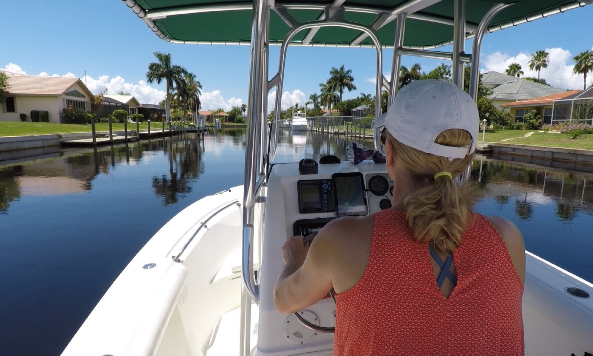
Hello, and welcome back to another video brought to you by Chris Mann! This is the second in our series showcasing a real time boat ride down Tarpon Inlet, located in Punta Gorda Isles (PGI). In this video we show you the Tarpon Inlet from the Marion Ave. Bridge south to Yellow Tail Lagoon and Sandfish Cove. We’ll talk about water depths, bridge clearances, and other issues important to local boaters.
To provide the best experiences, we use technologies like cookies to store and/or access device information. Consenting to these technologies will allow us to process data such as browsing behavior or unique IDs on this site. Not consenting or withdrawing consent, may adversely affect certain features and functions.
Functional
Always active
The technical storage or access is strictly necessary for the legitimate purpose of enabling the use of a specific service explicitly requested by the subscriber or user, or for the sole purpose of carrying out the transmission of a communication over an electronic communications network.
Preferences
The technical storage or access is necessary for the legitimate purpose of storing preferences that are not requested by the subscriber or user.
Statistics
The technical storage or access that is used exclusively for statistical purposes.The technical storage or access that is used exclusively for anonymous statistical purposes. Without a subpoena, voluntary compliance on the part of your Internet Service Provider, or additional records from a third party, information stored or retrieved for this purpose alone cannot usually be used to identify you.
Marketing
The technical storage or access is required to create user profiles to send advertising, or to track the user on a website or across several websites for similar marketing purposes.


